
Google Earth Exercise: Chapter 7
Geographies of Language
Belgium is exemplary of a multi-lingual country whose administrative borders do not reflect the underlying linguistic landscape. Sixty per cent of Belgians speak Dutch, 40 per cent speak French and less than one per cent speaks German. Despite the small minority of German-speaking Belgians, German toponyms prevail in the Eastern province of Liege. Similarly, French speaking Walloons in Belgium have maintained French place names in the southern and western reaches of the country, whereas the Flemish (Dutch-speaking) north maintains distinct linguistic traditions and place-names.
As described in your textbook, Belgium is an artificial state with borders that do not align with cultural or linguistic patterns.
The task: Using Google Earth, visit the administrative regions of Belgium and examine the cities, their predominant languages and how they align or differ from their surroundings.
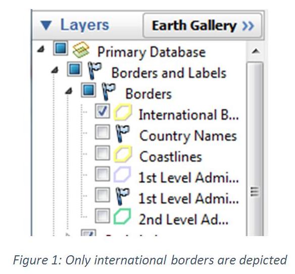
Step 1: Ensure that only “International Borders” are selected from the borders menu in the layers sidebar. Additionally, ensure that “labels” are activated from the same menu. Download chapter7.kmz to show the administrative regions of Belgium as well as three place markers that define the main linguistic territories.
Note: Clicking on any of the regions will indicate their name. Clicking on any municipality will bring up information pertaining to it, clicking through to the accompanying Wikipedia article will provide hints as to the predominant language used there.
Step 2: Search for the city of Mouscron.
Question 1: What language predominates in Mouscron? Where is it located (province)? Using the path or ruler tool measure the distances to the nearest large cities. What are the closest cities physically? In what jurisdiction are they located? What language is spoken there?
Step 3: Refer to pages 271–272 of the textbook for information on Belgium’s history as a multi-lingual country. Search for the city of Menen.
Question 2: In what province is Menen located and what language predominates there? Examine the satellite imagery. What does it suggest about the development of Menen?
Step 4: Search for the towns of Bütgenbach and St. Vith.
Question 3: Where are these towns located (province)? What is the capital of the province? What is the predominant language? What language is spoken in Bütgenbach and St. Vith? Examine the border to the east and contrast it with the western border of Belgium. Can you account for the settlement patterns of the German-speaking population?
When you have answered the three questions above, scroll to the bottom of the page to check your answers.
Answers:
Question 1: Mouscron is predominantly a French-speaking city and belongs to the French Community of Belgium, an administrative body representing French-speaking Belgians. It is located in Hainaut province, which is also French-speaking, and is located 6.6 kilometers from Roubaix in France (French-speaking) and 10 kilometers from Kortrijk in West Flanders, Belgium (Flemish, or Dutch-speaking).
Question 2: Menen appears to have developed in tandem with Halluin, irrespective of the national border imposed between the two cities. Despite being located in West Flanders (a Dutch-speaking province) Menen is a French-speaking city that has more in common with Halluin across the border.
Question 3: Bütgenbach and St. Vith are located in Liege, a French-speaking province of which the capital is also the French-speaking Liege. Both towns are German speaking and are in close proximity to the German border. Unlike Menen, for example, there is little development on the German side of the Belgian–German border exacerbating the isolation of the German-speaking towns.